Thursday, July 28, 2016

Kakadu


As we traveled north we spent one night at Mataranka Bitter Springs Caravan Park. This is right next to the entry to Elsey National Park and walking distance from the warm springs and swimming spots in the creek. Most enjoyable!
We passed through Katherine and on to Kakadu National Park were we had booked 5 days stay, promising ourselves a visit to Katherine Gorge on the way south again.
As we drove into Kakadu we were surprised by the hilly country we passed through in the south of the park and the grassy, lightly treed savannah country. We expected it to be mostly wetlands as featured in all the publicity. There was quite a lot of burning off happening but this is normal at this time of year. Seasonal burning has been part of the aboriginal land management for many thousands of years. Small fires when the winds are light prevent large hot destructive fires. As the fires are small the animals can escape them and they do not destroy all the trees. The vegetation recovers quite quickly, new grass grows encouraging animals into the area.


The highlight of the Kakadu experience was a cruise at Yellow Waters on the South Alligator River where there are huge areas of floating grasses with passages through with waterlilies, thousands of birds and of course, salt water crocodiles. The water was glassy smooth and the day perfect, the bird life was amazing. In the wet season most of these trees would be under water, but as the dry season progresses the water level will drop  and dry mud banks will be exposed.


 We spent a day exploring the northern part of the park where there are ancient rock escarpments with aboriginal rock art under sheltered overhangs.


Saturday, July 16, 2016

Alice Springs and on north


After viewing the whales we headed back east to Port Augusta and turned north up the centre of the continent to Alice Springs in the Northern Territory. (Often referred to as travelling “up the guts”)This was ground we had covered on previous trips but at Alice we ventured out into the West McDonnell Ranges in the Moke, an area we had previously overlooked. 
This was a round trip of 280km for the day visiting some spectacular gorges and gaps in the ranges caused by rivers eroding weak faults in the rock to force their way through over millions of years. 
The ranges themselves were formed when there was a major upheaval in the land so that the layers of rock tilted upwards. Over time the softer layers have eroded away in places leaving narrow walls of stone standing straight vertical as if man made. We would like to spend more time in this area as there are good camp spots and more to see.
 

Another day we visited the Alice Springs Telegraph Station (one of many on the old telegraph line) on the one week in the year that morse code operators were available and we were able to send a telegram to a young friend in Melbourne via Adelaide – messaging the old fashioned way!


From Alice we moved north where the gaps between tiny patches of civilisation grew further and further apart. From Alice Springs to Katherine it is 1542km with only the township of Tennant Creek of any size between. Anything else is just a fuel stop, store and pub (all in one) with a caravan park behind and perhaps a few of houses.

Tennant Creek is near the famous Devil’s Marbles rock formations.
 

Although there are no townships, the isolated roadhouses try to offer something to attract tourists, like Aileron not far from Alice Springs where a giant aboriginal warrior stands on the hill behind the buildings along with the town name in Hollywood style letters. They all have their own logos – bulls, eagles, frogs etc and have their own souvenir items for sale.


There is always something to see along the way in this vast land under blue skies - changing vegetation, landscapes and rock formations, and we were amazed to see how green the roadsides were after some recent unseasonal rainfalls.

Monday, July 4, 2016

Eyre Peninsula - west coast


Limestone cliffs at Leo Cumming Lookout

The west coast of the Eyre Peninsula is a lot more rugged than the east coast with high limestone cliffs, often dangerously under-cut by the waves. However the cliffs are broken up by stretches of sandy surf beaches and occasional bays some of which are quite sheltered.
We bypassed Coffin Bay and stayed 2 nights at Mt Dutton Bay where there is an old stone woolshed with a café. Unfortunately the weather was cold and windy so we were happy to move on to Elliston half way up the coast where the weather was better.


The Woolshed cave
Moving north we stopped off to visit the Talia Caves. The Woolshed cave was particularly interesting as the waves had penetrated the limestone which has a loose crumbly structure and had formed a large cave running back into the cliff face. The roof looked relatively thin considering the limestone’s weakness. At the bottom of the cliff the underlying pink sandstone was exposed with a contrasting rounded surface smoothed by the waves.
 From there we moved on to Streaky Bay.
The weather was good and we spent a couple of days exploring the area with a trip down the coast to a sea lion colony. The views were of rugged cliffs again.
Murphy's haystacks
On the way back we stopped off at Murphy’s Haystacks which are pink granite rock structures. They are not boulders sitting on the surface but are actually rising from the bedrock dated at around 1500 million years old and formed by cracking and erosion by wind and weather. They stand on the highest hilltop in the area and only appear in this one spot, some out in the open, others looking like a herd of elephants amongst the trees.
The Streaky Bay National Trust Museum had some interesting exhibits including a fine old wattle and dawb house still with the clay and straw “dawb” between the upright posts, not concrete which is the usual replacement. It is a credit to the staff there as the clay fill has to be replaced about 4 times a year. They also had an old car which was the only transport from the area to Adelaide in the 1930s. The lady owner/driver did her own repairs and at times strapped herself to the roof rack to sleep while her co-driver took over. It took several days to reach Adelaide over
Whale and calf
very rough roads.
After Streaky Bay we spent a night at Ceduna, then did a 600km round trip to the Head of the Bight to see the Southern Right Whales which come right up to the Bunda Cliffs to have their calves and spend the winter in the warm current that flows along the coast.

Sunday, July 3, 2016

Eyre Peninsula - east coast


Murray river at Loxton

We’re on the road again after a 2 year break so it’s time for a new blog.
We left home towards the end of May and headed across Victoria into South Australia through Loxton, Burra and across to Port Augusta. These are all areas we have covered in the past so we moved fairly quickly to this point. From here we were into new territory as we moved down the east side of the Eyre Peninsula.


Wyalla was our first stop and this town was a great surprise. All we really knew was that it was a steel town which had been in the news a lot recently due to the uncertain future of the steel works. There is much more to the area. 
We drove out to Point Lowly and Fitzgerald Bay with views of the Spencer Gulf.  We toured the HMAS Wyalla, a Bathurst class mine sweeper and anti -submarine boat, the first ship built at the shipyards in 1941. With a shallow, near flat bottom  and  only 9 feet below the waterline, she had an 80o  roll side to side, add to that moving through high seas and it was a very uncomfortable ride, often in overcrowded conditions due to rescues from sunken ships in the waters around the north of Australia.
The Mt Laura Homestead Museum had a wide range of exhibits and is worth a visit, and the signage on virtually every exhibit has notable spelling errors to the point where it almost seemed deliberate – perhaps for visiting school groups?
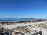
Tumby Bay jetty
We moved down the east coast of the Eyre Peninsula stopping at Cowell and Tumby Bay, both pretty little seaside towns, then on to Port Lincoln at the southern tip of the peninsula.The weather could have been better but we visited the Axel Stenross Maritime Museum where restoration work is still done on old vessels. An entertaining afternoon was spent on board the “Tacoma” a tuna fishing boat built at Port Fairy in the 1940’s and we learned a lot about tuna fishing in the Port Lincoln area.
Scruffy at Winter Hill lookout Port Lincoln